

Adaptive Basic Resource Recognition and Allocation Model
Welcome to ABRRAM!
The Adaptive Basic Resource Recognition and Allocation Model (ABRRAM) is an interdisciplinary initiative dedicated to enhancing disaster risk reduction and management (DRRM) through resource identification, allocation, and optimized distribution. Our model integrates cutting-edge technologies from various disciplines to assist local government units (LGUs) in effectively managing and distributing essential resources during times of crisis.
Join us in building resilient communities through data-driven solutions.
ABRRAM is a collaborative project bringing together experts from multiple constituent units of the University of the Philippines (UP). Our focus is on leveraging emerging technologies to optimize resource allocation and distribution within local government units (LGUs), particularly during disasters. The project is funded by the UP Intelligent Systems Center (ISC).
News and Updates
-
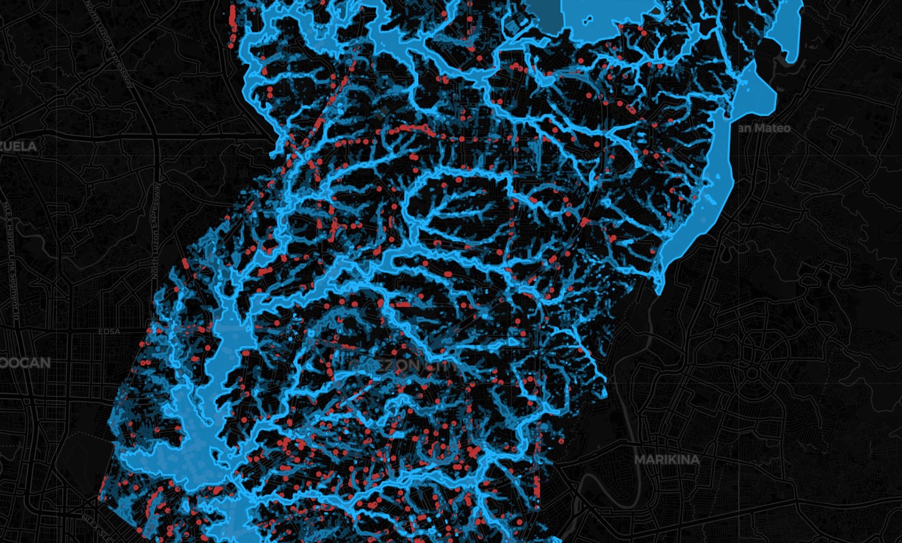
Metro Manila Cities Flood Hazard Maps from UP NOAH with Flood Reports from Waze
by
Explore interactive flood hazard maps of Metro Manila Cities from UP NOAH with Waze flood reports overlayed. Toggle between hazard levels and report reliability and zoom in for detailed city views. Note: Use the toggles at the top-right of the map to switch between flood hazard levels and Waze report reliability. Zoom in for a…
-
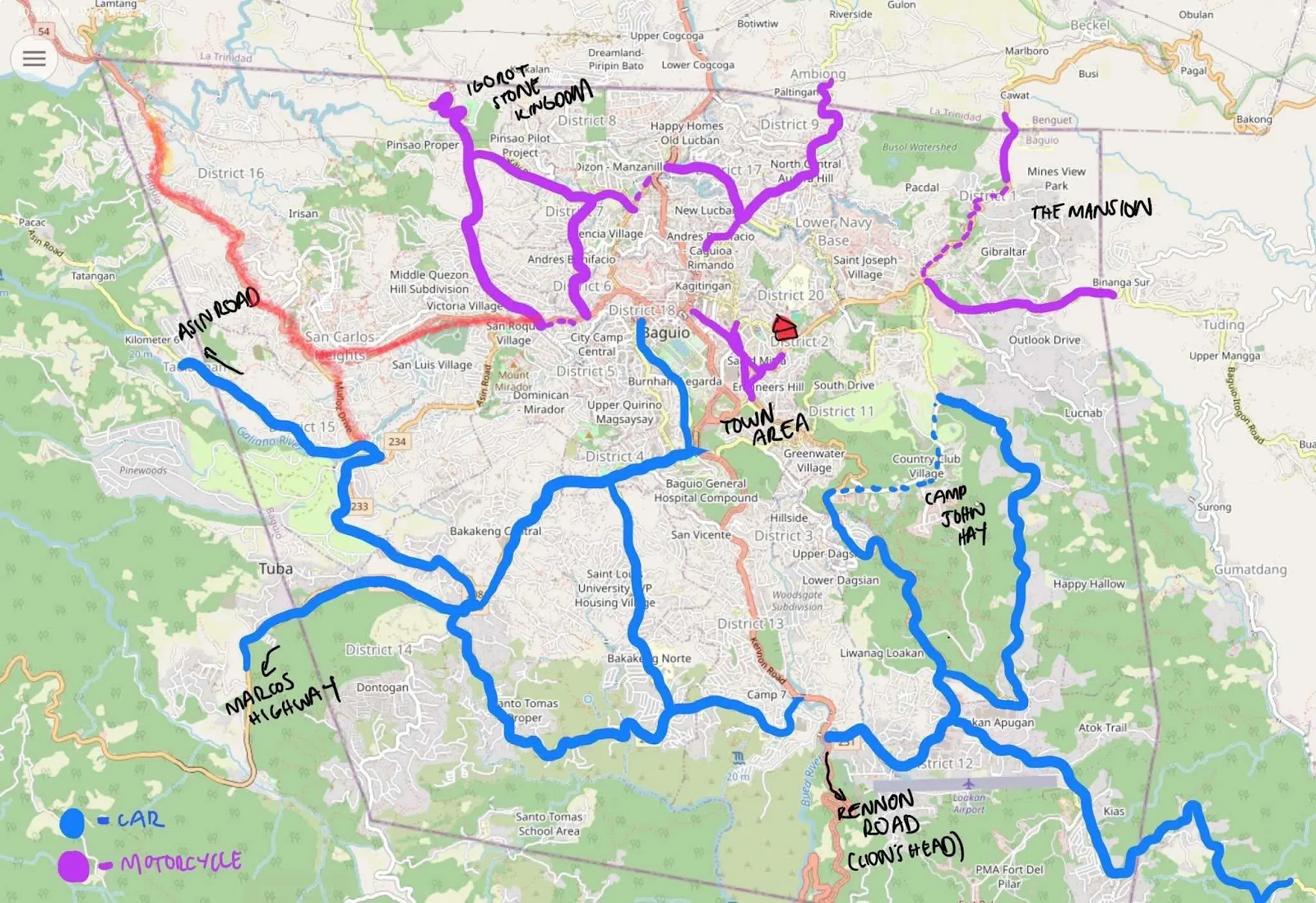
UP Researchers Map Baguio Roads to Help LGUs Spot Critical Facilities
by
Baguio City, Philippines — A small team of UP researchers recently took to the streets of Baguio armed with GoPro cameras to map critical infrastructure in the city. The goal? Help local governments better prepare for disasters by using community-generated data and open digital tools. This fieldwork is part of Project ABRRAM, a multi-campus UP…