

Baguio City, Philippines — A small team of UP researchers recently took to the streets of Baguio armed with GoPro cameras to map critical infrastructure in the city. The goal? Help local governments better prepare for disasters by using community-generated data and open digital tools.
This fieldwork is part of Project ABRRAM, a multi-campus UP initiative funded by the UP Intelligent Systems Center to develop smart, data-driven ways to detect and allocate basic resources before, during, and after disasters.
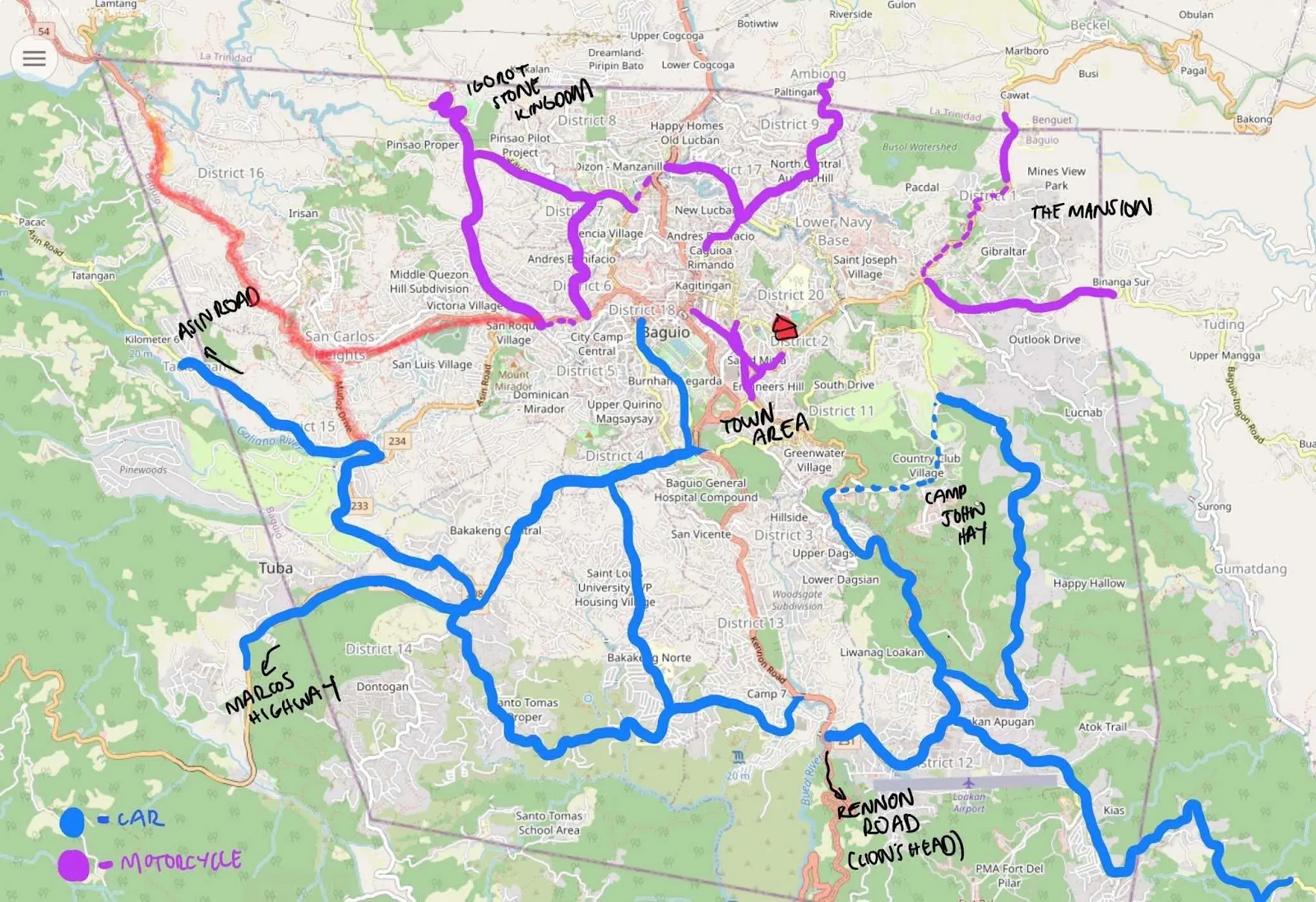
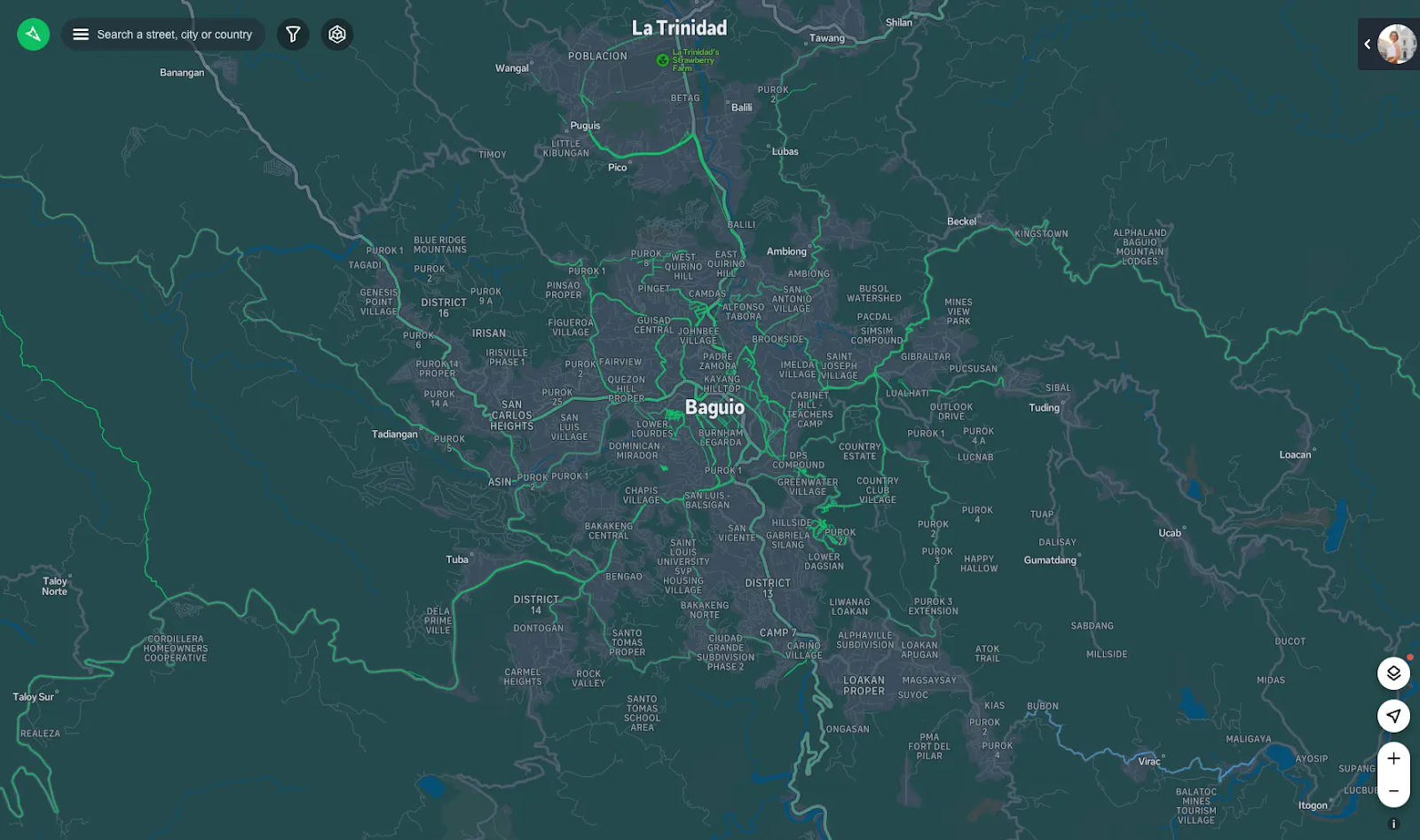
Led by UP researcher Feye Andal, the team collected over 15,000 street-level images, navigating more than 110 kilometers of Baguio’s roads, using Mapillary, an open-source platform that allows anyone to upload and view street imagery. Unlike satellite maps, which often miss smaller features like signs or gates, these ground-level images can help spot schools, evacuation centers, health clinics, and other essential facilities.
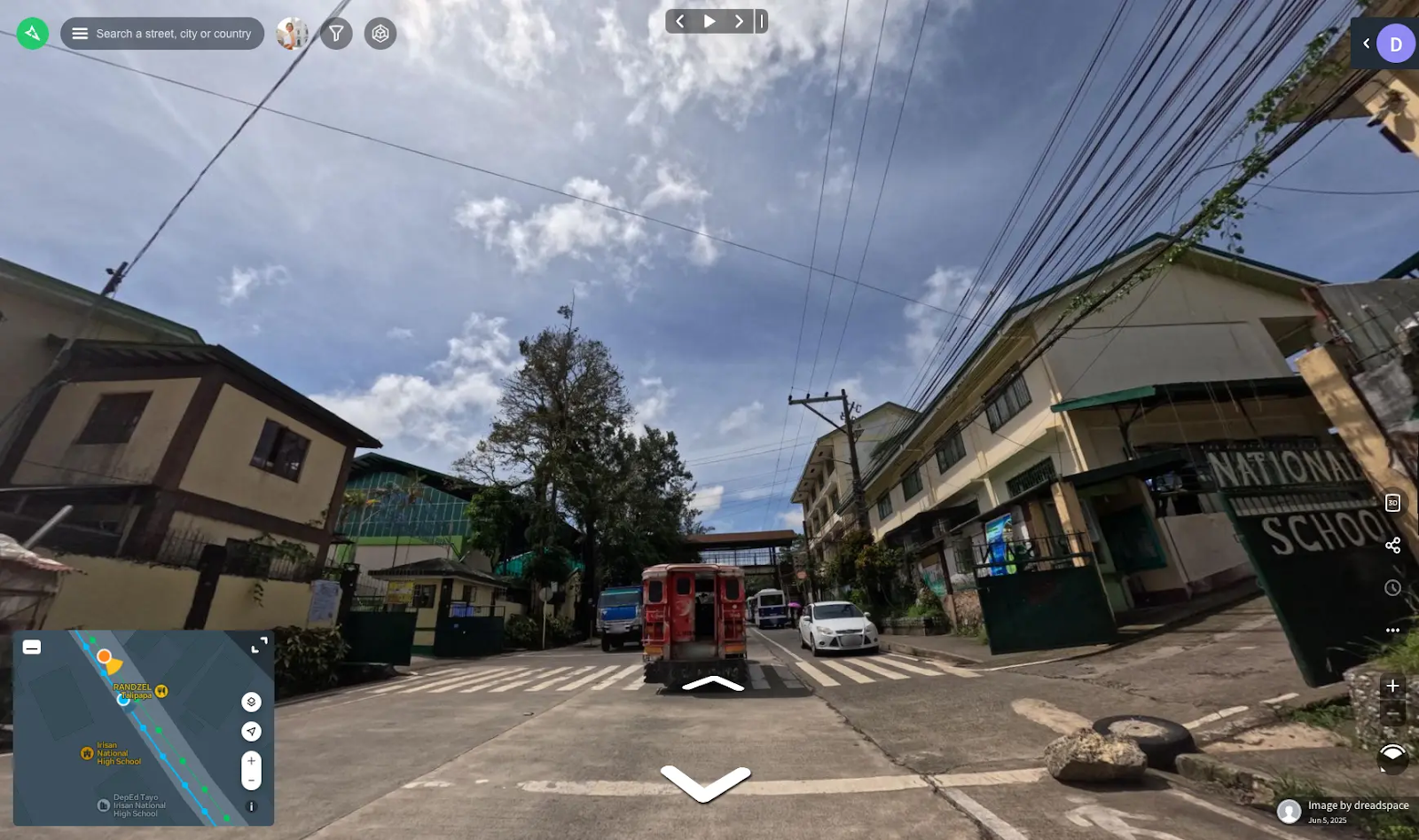
“In the Philippines, data on public infrastructure is often hard to access,” Andal shared. “But many of these places have signs you can see from the street. If we can capture those through imagery, we can map them ourselves.”
The team split up, one member covering major roads like Marcos Highway and Asin Road, another using a motorcycle to weave through narrower city streets. Despite sudden rain and steep roads, they successfully gathered data and are now feeding it into OpenStreetMap, a free global mapping platform.
What is the project’s next step? Using these images to train AI models that can automatically detect public facilities from street-level photos, potentially speeding up the process of identifying key locations for disaster response and planning.
Andal hopes the project inspires more communities to contribute to open mapping: “You don’t need much to make an impact. A camera, a weekend, and a sense of purpose can go a long way.”
Note: Images were taken from Feye Andal’s blog post (https://feyeandal.me/blog/field-notes-in-baguio-city)